Hotline:
(+84) 898 898 688Approving the red line of Ring Road 1 and De La Thanh
Vice Chairman of Hanoi People’s Committee Nguyen The Hung signed Decision No. 2577 / QD-UBND on the approval of the Red Line at Ring Road 1 and De La Thanh at the section of Hoang Cau – Lang Ha. 1/500, in Ba Dinh district and Dong Da district.
Accordingly, the location of the route is the point of intersection with Hao Nam – Hoang Cau, the last point intersection with Giang Vo – Lang Ha.
 Ring Road 1 is a major urban axis; De La Thanh level is the regional road. Ring road 1 with typical horizontal cross-section of B = 50m including: 2×15.5m wide road, 3m width separator, 2x8m wide side sidewalks. The detailed cross-section will follow the approved road construction project.
De La Thanh road has a typical cross section of B = 17m, including: 9m wide roadway, 4.5m wide pavement in the north, 3.5m south pavement. The strip between Ring Road 1 and De La Thanh Road is about 8-12m wide.
Belt line 1 passes through the ABCD points with coordinates and specifications recorded directly on the drawing (points B, C are determined by the coordinates of points B ‘, C’ are the points of change and the radius of the curve is equal).
De La Thanh road passing through points 1-2-3-4-5-6 with coordinates and specifications are written directly on the drawing (Points 3, 4, 5 are determined through coordinates The points 3 ‘, 4’, 5 ‘are the points of diversion and the radius of curvature).
The red line boundary is determined on the basis of the planned road heart rate, cross-sectional area, technical parameters, dimensions and combined with specific interpolation on the drawing.
The intersection between Ring Road 1 and Hao Nam – Hoang Bridge is the intersection of intersection, Giang Vo – Lang Ha intersection is another intersection level in the direction of Ring Road 1.
The crossroads intersecting Ring Road 1 and De La Thanh will be officially identified according to the detailed plan of the two sides of the Ring Road No.1 approved by competent authorities.
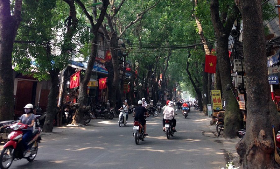

Hanoi People’s Committee assigned the Department of Planning – Architecture to inspect and certify the drawing of the red line at 1/500 scale according to the approval decision of the City People’s Committee; Approving the design dossier for marker planting; Handing over the file to the People’s Committee of Ba Dinh district and the People’s Committee of Dong Da district to manage the construction according to the approved plan.
The project management board of investment project construction civil and industrial. Hanoi shall assume the prime responsibility for organizing the publicization of dossiers of red-line markers already ratified; Organizing the design dossier for marking the route and submitting it to the provincial / municipal Planning and Architecture Service for approval, which shall serve as a basis for the provincial / municipal Natural Resources and Environment Services to deploy border markers on the field; Handing over landmark to Ba Dinh District People’s Committee and People’s Committee of Dong Da District.
At the same time, the Hanoi Planning and Construction Institute was assigned to update the dossier on the red line of the approved road in the detailed plan on the two sides of Ring Road 1, O Cho Dua – Lang Ha section at 1/500 scale. The People’s Committee of Ba Dinh District, People’s Committee of Dong Da District has the responsibility to coordinate with agencies implementing the work of announcing, placing demarcation, receiving dossiers and managing landmarks; To inspect and handle construction cases that violate the planning according to their competence and the provisions of law.
You are reading the article Approving the red line of Ring Road 1 and De La Thanh in the Real Estate category at https://realestatevietnam.com.vn/.Any information sharing, feedback please email to contact.vietnamrealestate@gmail.com, Hotline (+84) 898 898 688 (24/7).
Special thanks!


